← All women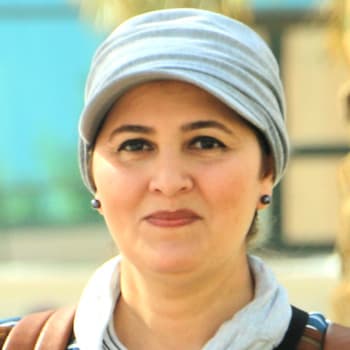
Egyptian · Science · Exploration
Eman Ghoneim
Unknown – present
Overview
Eman Ghoneim (Arabic: إيمان غنيم) is an Egyptian–American geomorphologist and remote‑sensing scientist whose work has transformed understanding of hidden landscapes in arid regions, particularly the Sahara Desert.[1][3][5] She specializes in the application of Geographical Information Systems (GIS), satellite and drone remote sensing, and hydrological and geomorphological modeling to flash‑flood hazards, groundwater exploration, sea‑level‑rise simulation, and the reconstruction of ancient river and lake systems.[1][3][5]
Ghoneim is best known for identifying an enormous buried paleolake in northern Darfur, Sudan, discovering the Kebira structure in the central Sahara with Farouk El‑Baz, and co‑leading the 2024 discovery of the Ahramat Branch, a long‑lost ancient channel of the Nile adjacent to the densest concentration of Egyptian pyramids.[1][2][3][5][8][13] Her research bridges physical geography, geology, climate history, groundwater resources, and archaeology, positioning her as one of the foremost contemporary geomorphologists of the Middle East and North Africa.
Early Life and Education
Published sources identify Ghoneim as an Egyptian scientist who later became Egyptian–American, but do not provide a verifiable birth date or detailed information about her early family life.[1][2][3] She grew up and was educated in Egypt, where she developed an interest in geography, geomorphology, and the use of spatial technologies to understand landscapes vulnerable to flash flooding and water scarcity.[1][5][10]
Ghoneim studied geography at Tanta University, a major public institution in Egypt’s Nile Delta. She completed her undergraduate work with honors and received a master’s degree in geography from Tanta University in 1997.[1][2][3][10] During her master’s studies she began working with remote sensing and GIS, laying the foundation for her later specialization in desert hydrology and geomorphological modeling.
Seeking further training, she moved to the United Kingdom to pursue doctoral studies in physical geography. She earned her Ph.D. in geography in 2002 from the School of Geography, University of Southamptonflash‑flood potential in the arid Red Sea region of Egypt, combining field observations, hydrological modeling, and satellite data.[8] This work made her an expert on desert flood hazards, an increasingly important topic as climate variability alters rainfall patterns in arid environments.
Early Career and Development
After completing her Ph.D., Ghoneim joined the Center for Remote Sensing at Boston University in the United States.[5] In 2003 she became a Research Assistant Professor at the center, working there until the summer of 2010.[5] Under the mentorship of Farouk El‑Baz and other senior scientists, she refined her expertise in interpreting radar and optical satellite imagery and in integrating these data into GIS‑based models.
At Boston University, Ghoneim conducted research on a range of desert environments, including the Red Sea coast of Egypt, where she analyzed flash‑flood vulnerability.[5][8] Her work combined geomorphology, hydrology, and remote sensing to identify areas at high risk of sudden, destructive flooding and to inform mitigation strategies. She also investigated the potential of buried river systems and paleolakes as sites for groundwater resources, oil, and natural gas.[5]
During this period she began to publish on the geomorphology of the Sahara and adjacent regions, building a reputation as a scientist able to reveal large‑scale subsurface structures in deserts using space‑borne radar imagery. Her collaborations with El‑Baz and other researchers connected her work to broader questions of Earth history, climate change, and human settlement in arid zones.
Academic Career at UNC Wilmington
Following her tenure at Boston University, Ghoneim joined the faculty of the University of North Carolina Wilmington (UNCW), where she is a ProfessorSpace and Drone Remote Sensing Lab (SDRS) Her lab focuses on integrating satellite data, aerial drone imagery, and advanced modeling to investigate: At UNCW, Ghoneim has secured research funding and led multidisciplinary projects that bring together geographers, geologists, archaeologists, and climate scientists. Her work has also provided training opportunities for students in cutting‑edge remote‑sensing techniques, contributing to the growth of Earth‑system science capacity at a regional university.[5][8][12] In March 2006, Ghoneim and Farouk El‑Baz announced the discovery of a large circular feature in the central Sahara, now known as the Kebira Crater or Kebira structure.[1][2] Using satellite imagery and GIS analysis, they identified an approximately 31‑kilometer‑wide ring structure at the border of Egypt and Libya that had not previously been described as a potential impact crater. Although further work is needed to conclusively determine whether Kebira is an astrobleme (ancient impact crater), the discovery highlighted how radar and optical imagery can reveal major geological structures hidden in remote desert regions.[1][2] The finding drew attention to under‑explored portions of the Sahara and opened new research questions regarding regional tectonics and impact processes. In 2007, while processing microwave space data and radar imagery, Ghoneim identified an enormous ancient mega‑lake buried beneath the sands of the Great Sahara in northern Darfur, Sudan30,750 square kilometers, making it comparable in area to modern large lakes. This discovery suggested that what is now hyper‑arid desert was once a major freshwater basin, with implications for past climate, ecological systems, and possible human occupation.[1][3][4] It also pointed to the potential presence of substantial groundwater resources associated with the ancient lake sediments, which could be crucial for water‑scarce regions of Sudan and neighboring countries.[5] The buried mega‑lake discovery is one of Ghoneim’s most cited contributions. It demonstrates her expertise in detecting subsurface hydrological structures using radar data and her capacity to link geomorphology to resource exploration and humanitarian concerns in conflict‑affected regions like Darfur. Ghoneim has also contributed to identifying the ancient Kufrah mega‑river system in Libya and Egypt, another large paleodrainage system revealed through remote sensing.[5] These buried channels may host extensive groundwater reservoirs and hydrocarbon deposits, underscoring the economic and environmental importance of paleohydrological mapping. Her broader work on paleorivers and paleolakes across North Africa helps reconstruct the region’s climatic evolution from wetter phases to the present aridity, and informs archaeological hypotheses about early human migration and settlement patterns in the Sahara. In 2024, Ghoneim and an international team used radar remote sensing to discover a long‑lost ancient branch of the Nile River near the largest concentration of Egyptian pyramids.[1][13] They named this channel the Ahramat Branch, using the Arabic word for pyramids to reflect its proximity to major pyramid fields. By analyzing radar data that can penetrate dry sand, the team identified a buried river course that appears to have flowed beside or beneath modern desert surfaces.[1][13] Ghoneim’s findings suggest that the Ahramat Branch was large enough to serve as a transportation waterway, carrying workers, stones, and other materials to pyramid construction sites during the time of the Old Kingdom.[1][13] The discovery has major implications for Egyptology and the study of ancient engineering. It provides a plausible solution to long‑standing questions about how massive building materials were transported to remote desert plateaus and strengthens the case that Nile branches and canals were integral to pyramid logistics. The work has attracted considerable media attention and has been followed up by field expeditions for ground‑truthing and carbon dating, which Ghoneim has led as principal investigator.[8][12][13] It exemplifies her ability to connect satellite‑based geomorphology with archaeological research and public interest in ancient Egypt. In December 2023, Ghoneim led a research expedition to Egypt from UNCW aimed at uncovering lost branches of the Nile and producing a more complete map of the river’s ancient courses.[8] As principal investigator, she coordinated co‑principal investigators from the University of Memphis, the University of Chicago, and Macquarie University in Australia, bringing together expertise in geoscience and archaeology. Subsequent work, highlighted in 2024 media coverage and WILMA magazine, has involved carbon‑dating sediments associated with the Ahramat Branch to confirm whether it was active approximately 4,000 years ago, during the peak period of pyramid construction.[13] These expeditions demonstrate Ghoneim’s role not only as a data analyst but also as a field leader capable of organizing international, interdisciplinary teams. Across her career, Ghoneim’s research has centered on several interlocking themes: These contributions have made Ghoneim a prominent figure at the intersection of geomorphology, hydrology, and remote sensing, and have practical applications in disaster risk reduction, water resource management, and heritage conservation. Publicly available sources highlight Ghoneim’s scientific discoveries and leadership roles but do not list a comprehensive catalog of formal awards or honors. Her work has nonetheless received significant recognition through: As of the available data, specific prize names or dates are not documented in major reference sources. Her recognition is primarily reflected in academic and public visibility rather than in an enumerated list of awards. Sources identify Ghoneim as Egyptian/American, implying that she later acquired U.S. citizenship or permanent residence, but they do not provide detail on her personal life, including marital status, children, or family background.[1][2][3][5][17] Editorial and institutional profiles focus almost exclusively on her scientific work and professional roles. Given the lack of reliable published information, her personal life remains largely private, and no further claims can be made about her relationships or family without speculation. Although Ghoneim is a contemporary scientist still actively conducting research, her work already has notable historical significance. As an Egyptian woman geomorphologist leading major international projects, she represents an important example of women’s advancement in Earth sciences and in scientific leadership from the Arab world. Her discovery of the Darfur mega‑lake and other paleohydrological features contributes to reimagining the environmental history of the Sahara, shifting views of the region from timeless desert to a landscape with dynamic wet phases and potential hidden water resources.[1][3][4][5] This has implications for humanitarian planning, resource management, and climate‑change research. The identification of the Ahramat Branch provides a new framework for understanding how ancient Egyptians built and supplied their pyramids, linking geomorphology with one of the most iconic achievements of human civilization.[1][13] It illustrates how modern remote‑sensing technologies can solve long‑standing archaeological puzzles and underscores the value of collaboration across disciplines. In the context of women’s history, Ghoneim’s career showcases the role of women scientists from the Global South in shaping global knowledge of Earth systems. Her leadership at UNCW and in field expeditions, as well as her contributions to high‑impact discoveries, challenge historical patterns of underrepresentation and demonstrate the possibilities for women in geoscience to drive major research agendas. As of the mid‑2020s, Ghoneim continues to serve as a Professor at the University of North Carolina Wilmington and directs the Space and Drone Remote Sensing Lab.[5][17][18] She remains actively involved in research on Nile paleochannels, flash‑flood hazards, and sea‑level‑rise impacts, and she leads ongoing expeditions to Egypt to ground‑truth radar‑identified features and refine chronologies of ancient waterways.[8][12][13] No reliable source reports a date of death; she is presumed to be living and professionally active. Her future work is likely to further integrate high‑resolution satellite and drone data with hydrological and archaeological modeling, continuing to reveal hidden stories beneath desert sands and coastal plains.Major Scientific Discoveries
The Kebira Structure (2006)
Buried Mega‑Lake in Northern Darfur (2007)
Kufrah Mega‑River System and Other Paleohydrological Work
The Ahramat Branch of the Nile (2024)
Research Expeditions and Field Leadership
Research Themes and Contributions
Awards, Honors, and Recognition
Personal Life
Legacy and Historical Impact
Later Life and Ongoing Work
Dated achievements
1 indexed.
- Mar012006Science
Co-Discovery of the Kebira Crater in the Sahara
Ghoneim and Farouk El-Baz identified Kebira Crater, a possible massive impact crater in the Libyan Sahara, using satellite radar imagery analysis.
View details Eman Ghoneim - Wikipedia